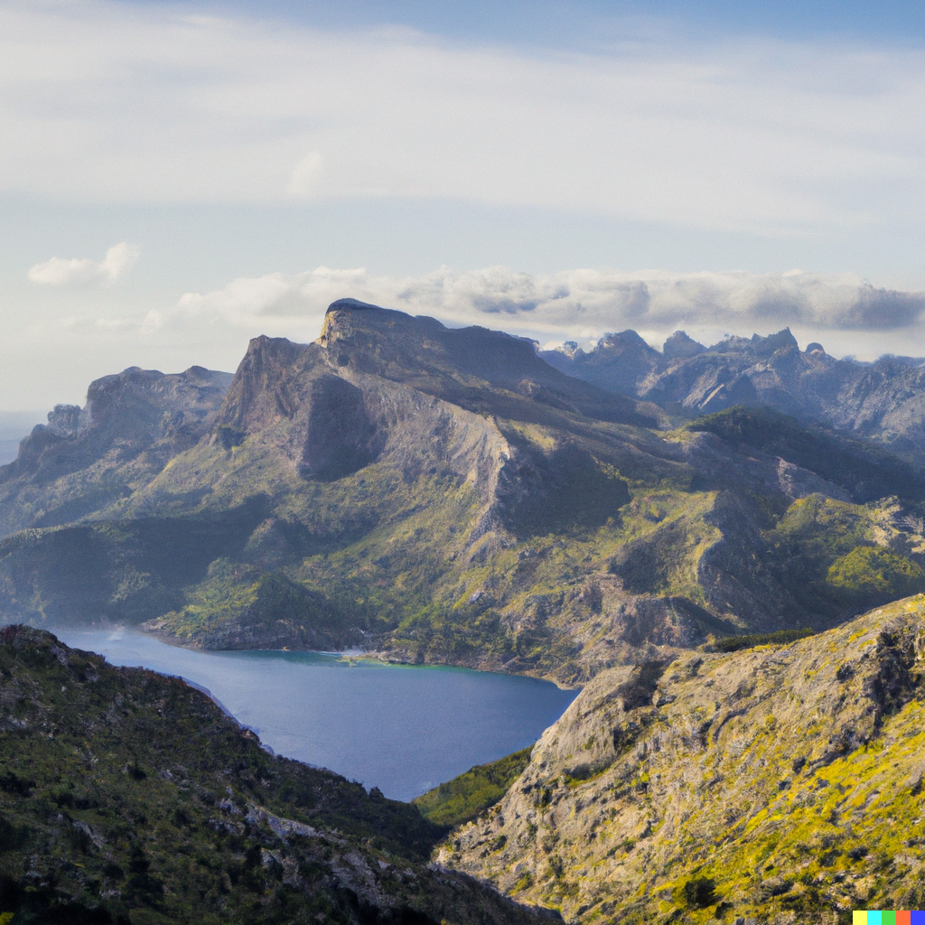
Sa Travessa
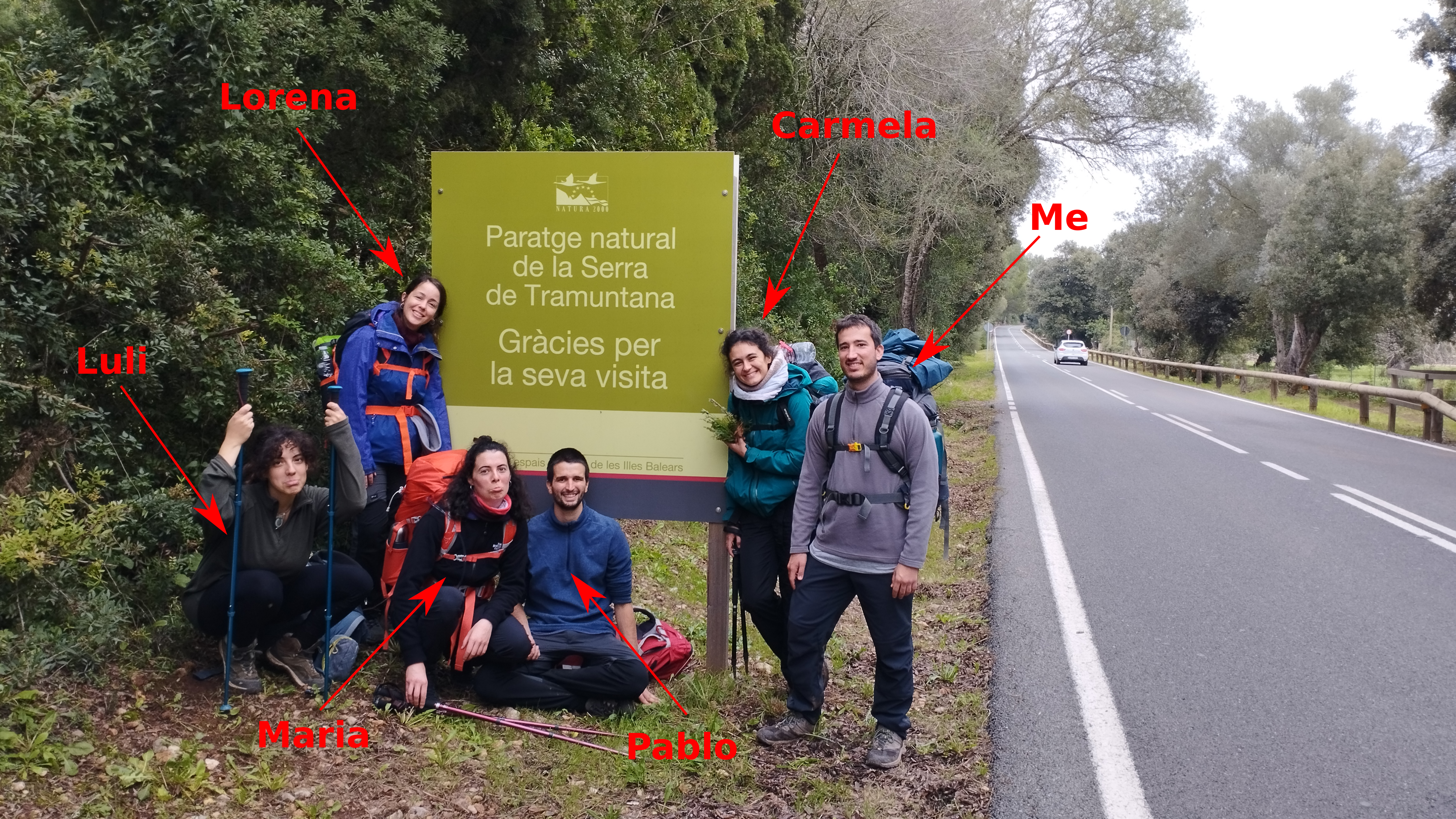
After almost three years in Mallorca, I finally carried out “Sa Travessa”, a several days hike from side to side of the Tramuntana mountain range. I had the pleasure to share this experience with some friends who also enjoy hiking: Pablo, María, Lorena and Carmela. Other friends like Bea, Medea and Luli came also to some of the stages, which was somehow refreshing!
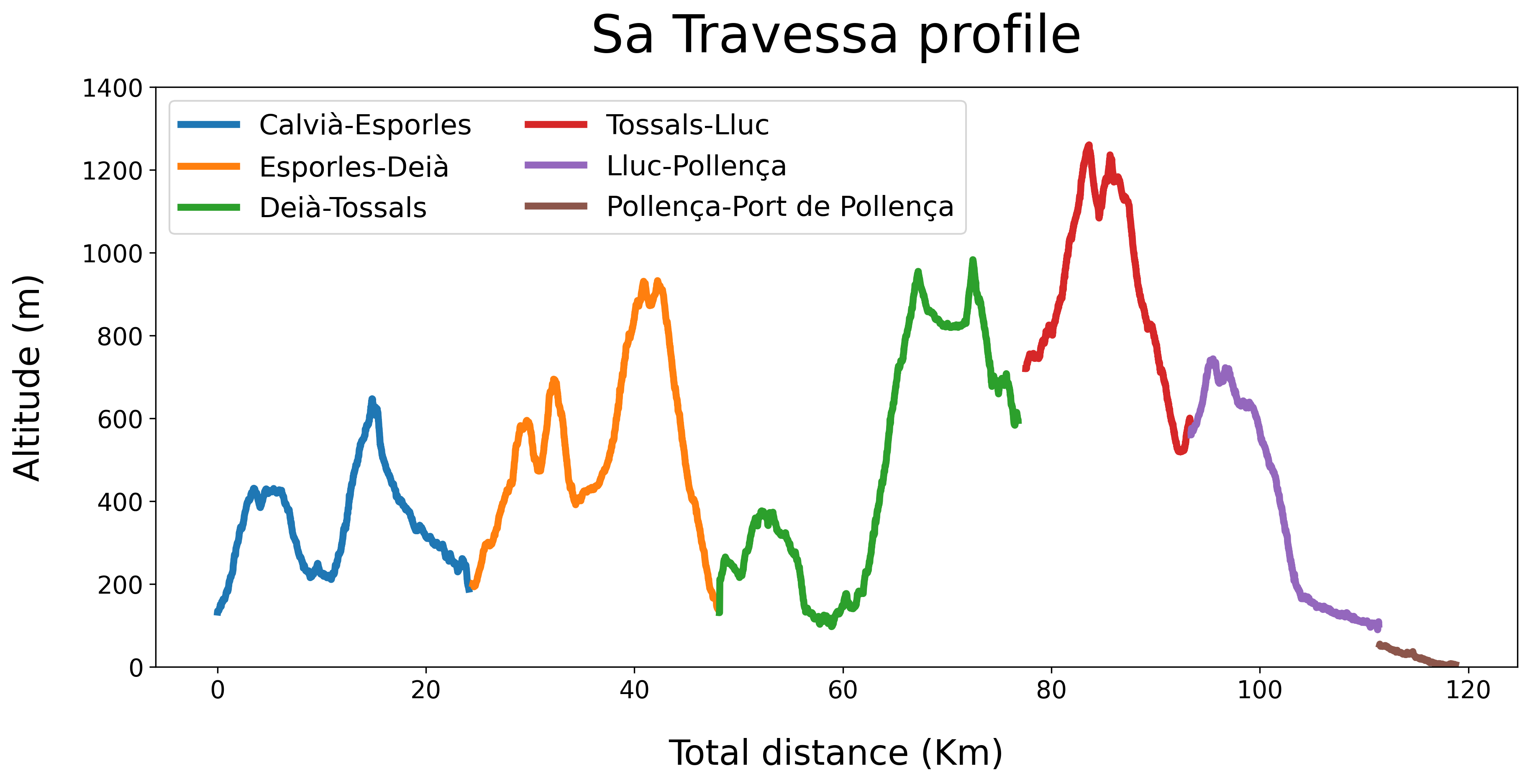
The trip started at Calvià on Saturday 3rd of December of 2022 and finished at Port de Pollença the Thursday 8th of December after 6 days with almost 120 Km walked and 5000 m of elevation gained. We divided the long hike into 6 stages, which are summarised in the table below:
| Stage | Distance | Elevation Gain | Elevation Loss | Moving Time | Total Time |
|---|---|---|---|---|---|
| Calvià-Esporles | 24 Km | 892 m | 819 m | 5h 52min | 8h 39min |
| Esporles-Deià | 23 Km | 1340 m | 1390 m | 6h 25min | 8h 45min |
| Deià-Tossals Verds | 28 Km | 1683 m | 1283 m | 7h 48min | 10h 49min |
| Tossals Verds-Lluc | 16 Km | 783 m | 914 m | 4h 42min | 7h 28min |
| Lluc-Pollença | 18 Km | 188 m | 668 m | 4h 57min | 7h 22min |
| Pollença-Port de Pollença | 7 Km | 0 m | 50 m | 1h 25min | 1h 30min |
Certainly the first three stages were quite intense!
Nevertheless, we had plenty of time to enjoy the beautiful views and do some crazy things…
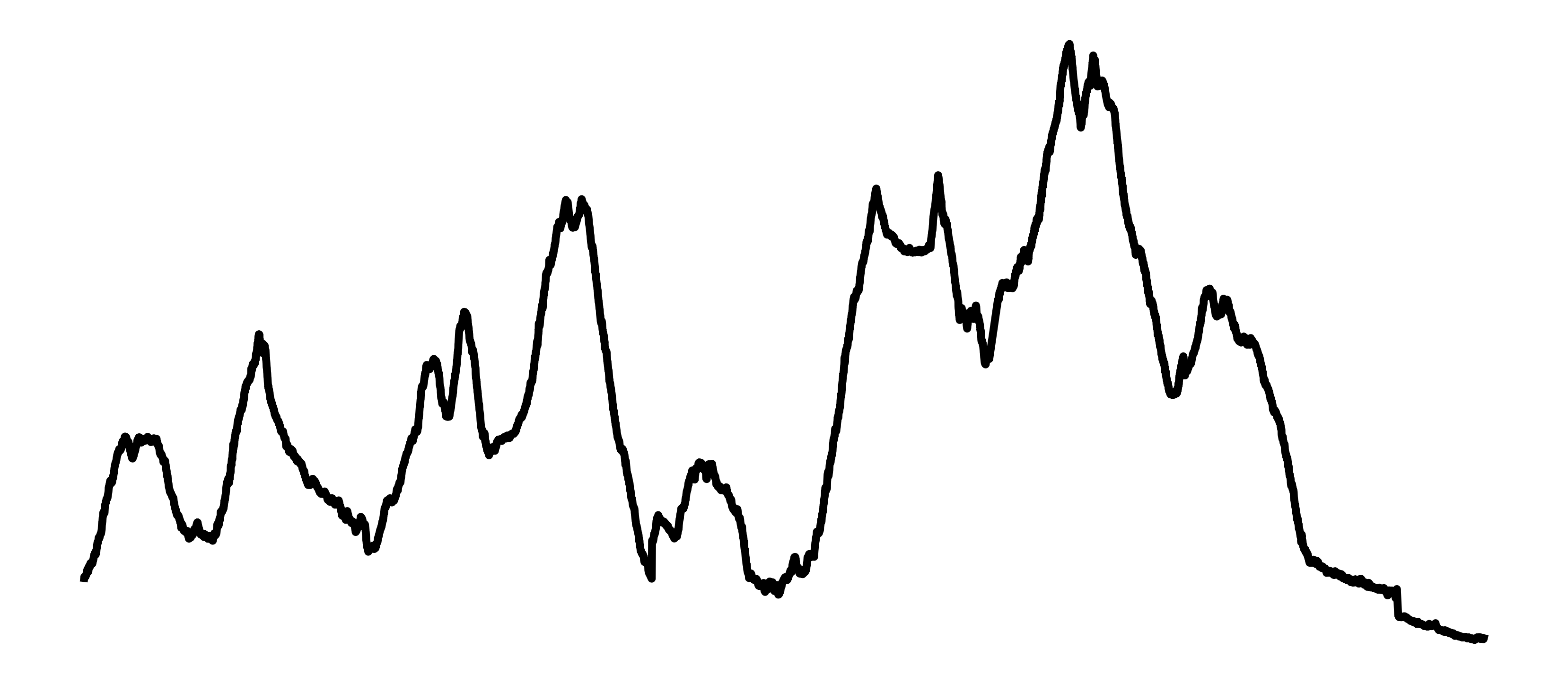
As the geek I am, I decided to download the data from the Wikiloc trails that Carmela and Maria recorded and access it using Python with gpxpy library. Then I could plot the nice profile of the stages with few lines of code, look below!
Another cool thing I did is an interactive map of our full trip, showing the starting and ending point of each stage and the path we followed. Click on the red line to check the stats of each trail and click the title to go to the Wikiloc record!